Using Color to Predict Antler Growth Potential
Filed under: Deer Hunting, Hunting Blog, Hunting Tactics
In a blog entry earlier this week, Using Maps To Plan Where to Hunt this Fall, I shared a source of data from the NOAA in the form of a map that predicted precipitation or the lack of for the next few weeks in the Lower 48. Precipitation levels can be correlated with forage production and quality. Too much or too little precipitation can limit plants ability to transfer nutrients from the soil to deer.
Deer require high quality nutrition on a year round basis to express their full antler growth or fawn production potential. I doubt many free-ranging, wild deer express their full potential. The stress of avoiding predators, lack of quality forage, parasites, diseases, injuries, etc., all reduce a deer’s ability to express their full potential. Of these, it’s easiest for hunters to predict the quality of forage available when planning where to hunt during the upcoming season.
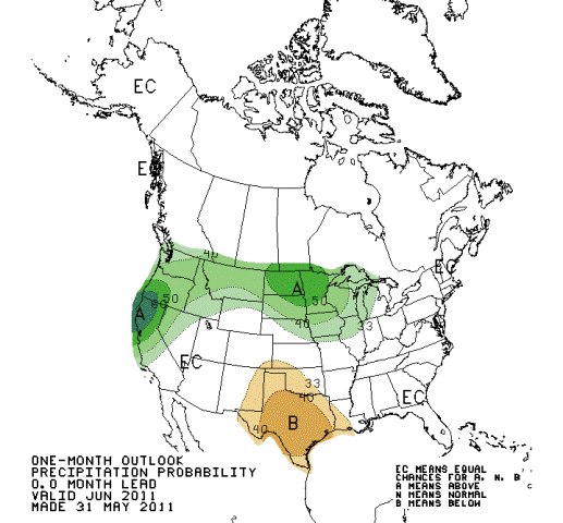
This time of year many whitetail and elk hunters are applying for tags in states where they are not residents. If antler potential is a factor of where you are deciding to hunt, I encourage you to study the following map based on NOAA data.
Precipitation amounts during spring green-up are critical to the antler development that year. Many forage plants (native and cultivated) are highest in digestible nutrients during the spring. If too much or not enough precipitation occurs during this time of year, the quality of forage and therefore quality of antlers can be reduced.
This is critical data to consider if you are planning an out of state hunt with the goal of harvesting a buck that has expressed a high percentage of his antler growth potential.
Based on the following map, most of west Texas, Oklahoma, and southwestern Kansas received way less than normal precipitation during the critical spring green-up period this year. Most of the Ohio River Valley and southern Missouri and Northern Arkansas received way more precipitation than normal during this same period of time. I suspect antler development will be less than average in both of these areas.
Much of the Midwestern corn belt received about the normal amount of precipitation during the same period of time. If this pattern continues throughout the summer, antler development should progress well in these areas.
Most of us have limited time and funds for hunting. By using the data from the map in this and the previous blog, those limited hunting days can be spent in areas where antler development may be the best this fall. Maps are one of the most useful scouting tools!
Growing Deer together,
Grant


